Saturday, 30 August 2014

Two Test Pits

Photos from the test pits in two gardens in Athersley North.


Wednesday, 30 July 2014

Garden Test Pits

Here are some photos of this summer's test pits beside Sandra's Convenience Store. We have excavated the remains of an old farm that once stood where the store and Rufford Avenue are today. The farm is shown on Ordnance Survey maps in the second half of the 19th century. We are hoping to find objects from its history and to see how old it is.


Part of a farm stone wall.

Remains of the farm behind Sandra's.


Monday, 26 May 2014

Hands on Historhy Exhibition

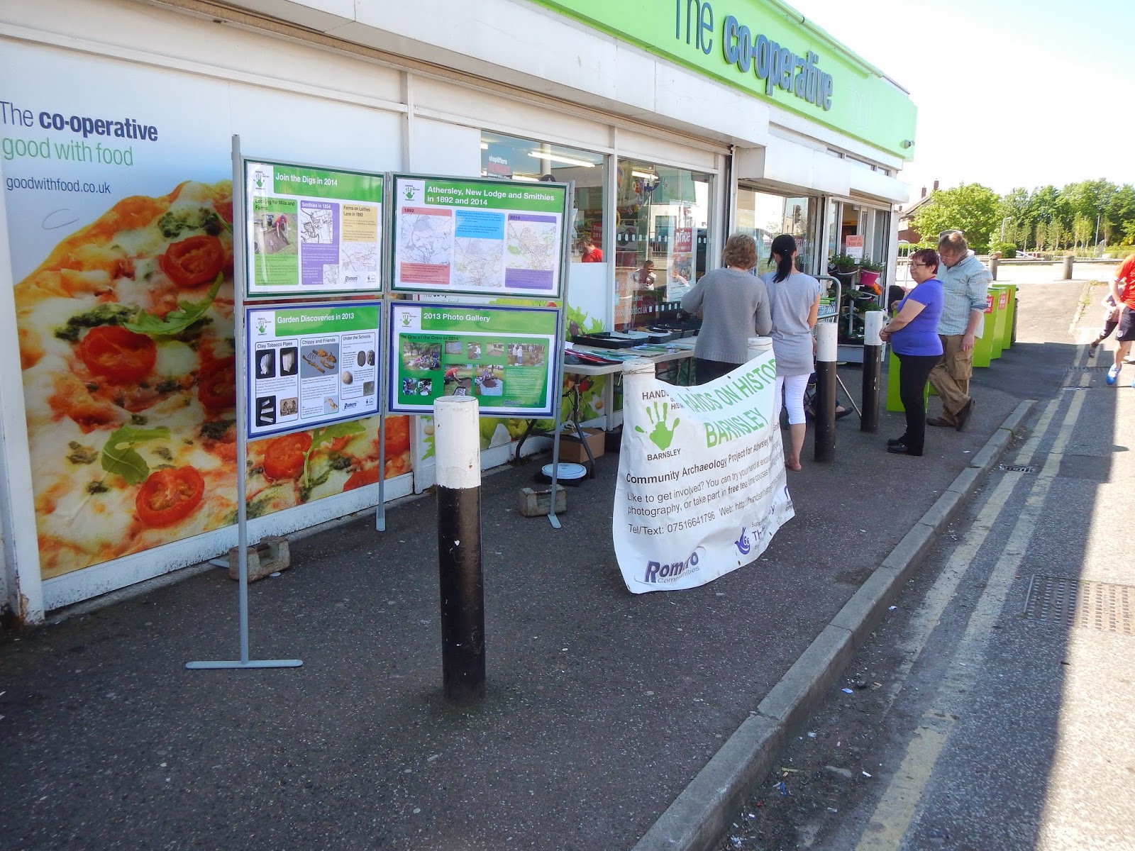
Have a look at the exhibition if you missed it last week. Click on an image to see it large enough to read.


Monday, 19 May 2014

Finds Roadshow

We display and exhibition of finds from 2013 outside the Athersley Co-op on Saturday 17th May. Beryl, Carol and Sylvia did a great job telling people about what we found and signing up volunteers for this year.


Thursday, 1 May 2014

See the Finds from Athersley’s Past


Athersley Archaeologists will be showing off their archaeological finds outside Athersley Co-op on Saturday 17th May between 11am and 3pm. The finds come from test pits dug all over Athersley and New Lodge last September as part of the Romero Communities’ Hands on History project. As well as having the chance to handle the finds, there will be an exhibition about the dig and Athersley’s past, and the chance to sign up to have a go this year.
Athersley Archaeologists are residents of Athersley, New Lodge and Barnsley who are learning how to dig, wash finds and finding out about Athersley’s past. The test pits were dug in gardens and the three local primary schools. Each one metre square hole was a window into the past beneath our feet. Some of the star finds include a piece of pottery over 600 years old, a Georgian fob seal used by a gentleman to sign letters, Victorian clay tobacco pipes and a potty – a small clay ball used in the miners’ traditional game of knurr and spell.

Carol Clair of Romero Communities says “Last September was amazing because of what we found. Who would think there was so many clues from hundreds of years of history before most of the houses were built. Twenty adults and over 100 school pupils excavated 42 test pits and washed all the finds in three weeks.”

Most test pits will be dug in May and July this year. Anyone can become an Athersley Archaeologist as the team provide the tools and training. For the less able finds sorting and washing while having a natter and cuppa is also an option. This year the aim is to find out more about the old mills at Smithies and the farms near Laithes Lane.

Archaeologist Bill Bevan, leading the project, says “We hope to finds objects thrown away by Victorian or earlier farmers as well as evidence for Smithies’ corn and wool mills which date back hundreds of years.”

If you would like to find out how you can get involved contact Chris on 01226 722571 or 07963 586767. You can also find out more online at http://handsonhistorybarnsley.blogspot.co.uk/ or the Facebook Group Hands On History Barnsley.

Tuesday, 29 April 2014

Athersley, New Lodge and Smithies Today and in 1892


See the difference a hundred and 20 years make! We've overlain the 1892 Ordnance Survey map on the modern map to show the dramatic changes to the Athersley landscape - then and now. See Victorian woodlands, railway lines, pits and farms appear from the past. Find out what used to be where your house is today.


Some of the roads are the same including the Barnsley to Wakefield Road. Parts of Laithes Lane, Laithes Crescent and Smithies Lane existed in 1892.


Some of the boundaries of Athersley North and New Lodge are defined by the routes of the Barnsley Coal Railway Extension and the Wharncliffe Woodmoor Colliery Branch. These were built between 1854 and 1892 to transport coal from Wharncliffe Woodmoor and other collieries.


There was a farm where Athersley South Primary School is today. Woodlands and fields occupied most of the land with the Victorian collieries built between 1854 and 1892 south of Athersley and at Carlton.


Contains Ordnance Survey data © Crown copyright and database right 2014.  


Tuesday, 22 April 2014

On the Road with Richard Newman Primary School

Pupils of Richard Newman Primary School looked at the location of their school on a Victorian road and the sort of people who would have travelled by. They drew artwork about these characters and produced a collage booklet of their work.

Download On The Road